Field manual · 11/17
Weather & Sky
Weather and light conditions for the position you are looking at — not just where you are standing. Both tools read the map centre, so you can check the far side of a ridge before you cross it.
the weather forecast
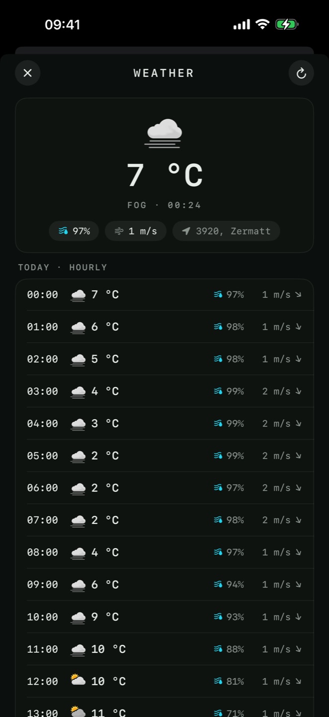
Tools → Weather Forecast gives the forecast for the crosshair position. It is also one tap away from the Position screen, from any pin's details, and from the Navigate sheet — which is how you check conditions at a destination rather than at the start point.
Hourly and daily
Each day is broken into an hourly strip with conditions, temperature, precipitation and wind. Days are labelled Today, Tomorrow and then by date.

Your units
Temperature follows your Temperature Unit, and wind follows the separate Wind Speed setting — so you can read temperature in Celsius and wind in knots, which is what marine and aviation work actually needs.
Derived conditions
The conditions panel adds the numbers that matter in the field: Dew Point and the temperature–dew-point Spread, a Fog Risk read-out (None, Low, Moderate or High, colour-coded), an estimated Cloud Base in your altitude unit, plus Pressure and Cloud Cover. A tight spread with high fog risk is the warning you want before committing to a valley or a flight.
sun & moon
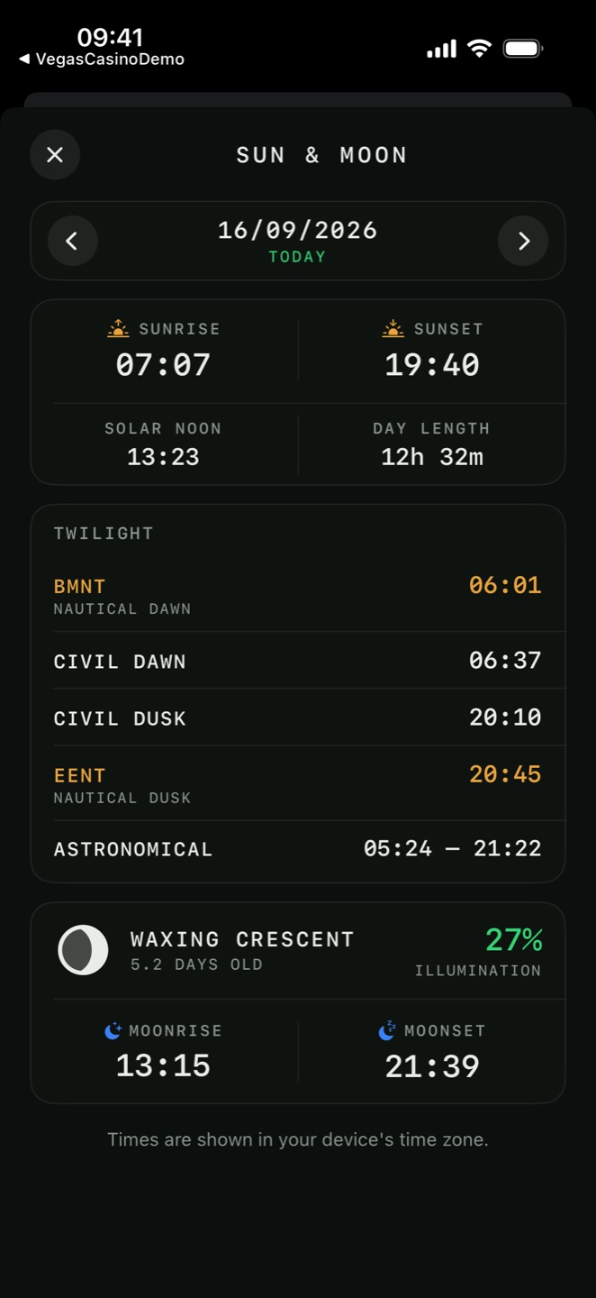
Tools → Sun & Moon computes the light for the map-centre position and a date you choose. It is entirely offline — pure astronomy, no network — so it works anywhere, at any time, including in airplane mode.
Pick any date with the date control, or tap Today to jump back.
Live position of the sun and moon
For today, a Now panel shows the current Azimuth and Altitude of both the sun and the moon, refreshed as time passes — the azimuth in your north reference and angle unit. A body below the horizon says so. It is the quick way to know where the sun is right now for shadow, glare or a solar bearing.
| Readout | Meaning |
|---|---|
| Sun | |
| Sunrise | Upper limb of the sun reaches the horizon |
| Sunset | Upper limb drops below the horizon |
| Solar Noon | Sun at its highest — true south or north, and the shortest shadow of the day |
| Day Length | Sunrise to sunset |
| Twilight | |
| BMNT | Begin morning nautical twilight — nautical dawn |
| Civil Dawn | Enough light to work and read without artificial light |
| Civil Dusk | That light is gone |
| EENT | End evening nautical twilight — nautical dusk |
| Astronomical | Full darkness begins and ends |
| Moon | |
| Moonrise | Moon reaches the horizon |
| Moonset | Moon drops below it |
| Illumination | Percentage of the disc lit |
| Moon age | Days since the new moon, with the phase |
reading the twilight times
Twilight is graded by how far the sun is below the horizon, and each band changes what you can actually do.
- Civil
- Sun 0–6° below. You can read a map and move over ground without a light. The horizon is sharp.
- Nautical
- Sun 6–12° below. The horizon is still faintly visible against the sky — the band that BMNT and EENT bracket.
- Astronomical
- Sun 12–18° below. Effectively night; only the brightest stars were visible before this, and now all of them are.