
Field manual · 07/17
Navigation & Directions
Navigate to a single point with a compass and a bearing, or follow a route waypoint by waypoint with the map rotating under you. Both work with the screen off, and both mirror to an Apple Watch.
generated directions PRO
Add → Directions builds a route between points along real ways. Six profiles:

Car and Walking
Roads and pavements — getting to the trailhead rather than along the trail.

Hiking
Footpaths and tracks, weighted the way a walker would choose them.
Trekking Bike
Surfaced and semi-surfaced routes suitable for a touring bicycle.
Mountain Bike
Trails and rough tracks.

River
Waterways, for a paddled route.
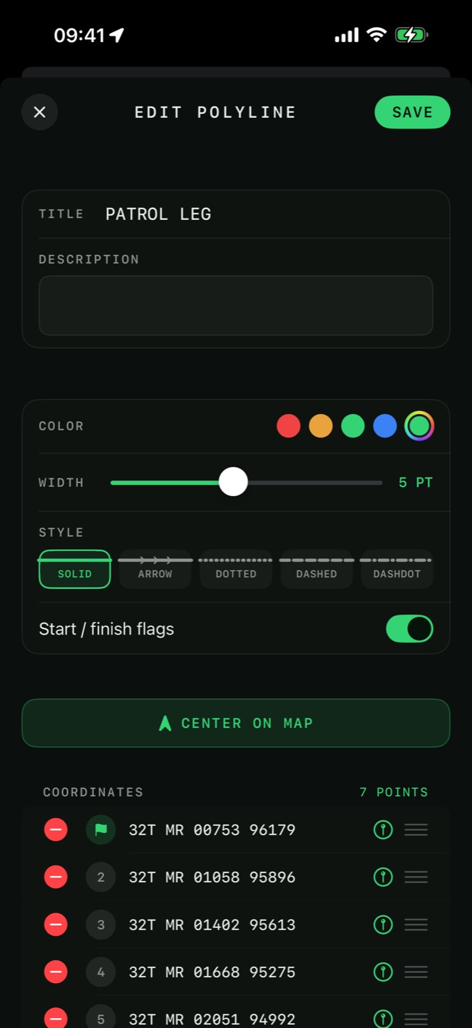
the elevation profile
Any saved line or route — generated, drawn or recorded — has an Elevation Profile, reached from its tap menu or from a measurement summary. It is now a free feature, full length rather than just the end points.

Slope-coloured chart
The height curve is coloured by steepness against a slope legend, so the hard pitches stand out at a glance.

Up and down split
Separate Uphill and Downhill cards give the distance and average grade climbed and descended, with the steepest grade each way — the ascent and descent read on their own, not just a net figure.

Estimated time
An Estimated Time for the route, with an Activity picker (Walk, Hike, Run, Bike), a Method (Tobler, or Naismith + Langmuir) and a Pace slider to tune it to your own speed.
navigating to a point
Three ways to hold a bearing, from most to least information on screen:

Compass Navigation
A full-screen compass with the target marked on the ring. Distance, bearing and elevation difference sit under it. This is the one to use in poor visibility, because it does not ask you to interpret a map.

Direct Line
A straight line drawn on the map from your position to the target, with the readouts in a card. Good when the terrain between matters.

Map-Based Navigation PRO
The map follows you, rotating as you move, with the guidance card over it.
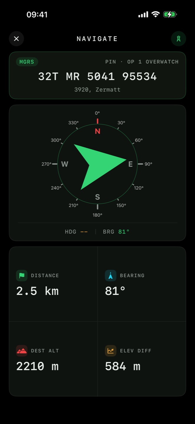
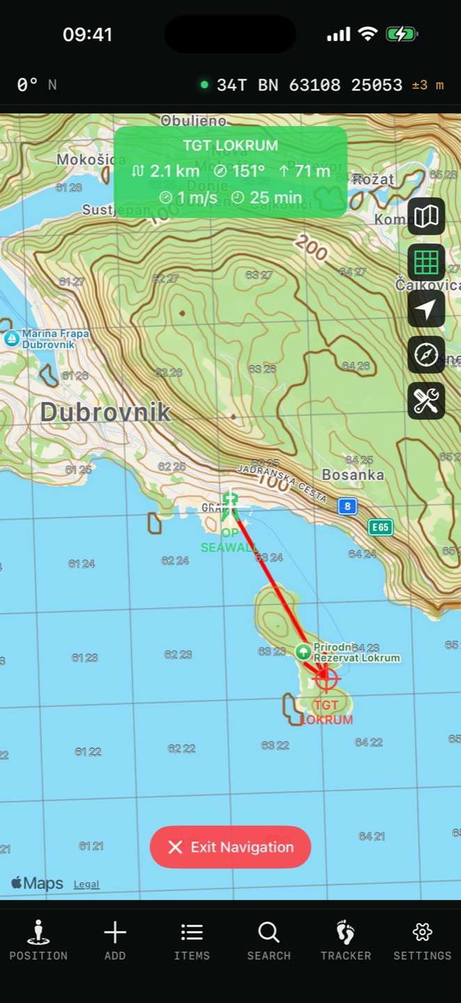
what the guidance card shows
- DIST
- Distance to the current target
- BRG
- Bearing, in your chosen north reference and angle format
- ETA
- Clock time of arrival at your current pace, not a countdown
- WPT
- Which waypoint of how many, on a route
- OFF ROUTE
- How far you are from the route line
- Back azimuth
- The reciprocal bearing — the way home
- Elevation Δ
- Height difference between you and the target
- Slant range
- True line-of-sight distance, including the height difference
navigation settings
Settings → Route Navigation:
| Setting | Options |
|---|---|
| Automatically go to next point | Advances to the next waypoint on arrival instead of waiting for you |
| Off-Route Alert | On or off |
| Off-Route Distance | Automatic (50 m / 100 m), 25 m, 50 m, 100 m, 200 m, 500 m |
| Map Rotation | Heading Up · Course Up · North Up |
| Show map in navigation view | Keeps the map behind the guidance card |
| Continue Navigation in Background | Keeps guidance alive with the app closed |
| Geofence Approach Tones | Audio cues near a geofence — see Pins & Shapes |
| Keep Screen On While Navigating | Stops the display sleeping |
arrival, background and the watch

Arrival
Reaching a waypoint plays a chime, taps the device and shows an Arrived at destination capsule. On a route with auto-advance on, the next waypoint becomes the target immediately.

Background navigation
With Continue Navigation in Background on, guidance survives locking the phone or switching apps. A Live Activity puts the target name, DIST, BRG, ETA, WPT and OFF ROUTE on the Lock Screen and in the Dynamic Island, with a tap to reopen the app.

The watch mirrors the target
The Apple Watch NAV screen shows the arrow, distance and ETA for whatever the phone is navigating to, and taps your wrist on arrival using the phone's own arrival test — so the two can never disagree. See Apple Watch.
ar navigation PRO
Navigate → AR Navigation puts the target on the camera view: a reticle over its real position with live distance and bearing, and an edge chevron showing the turn angle when the target is off-screen.
backtrack
From any recorded session, Backtrack navigates you back along the exact path you walked — with the compass, or on the map. Record on the way in, and walk out the same way in fog, darkness or featureless terrain.