
Field manual · 14/17
Import, Export & Backup
Your data is yours. Sixteen formats come in, nine go out, and one archive moves the entire app — layers, tracks, maps, presets and settings — to a new iPhone.
importing
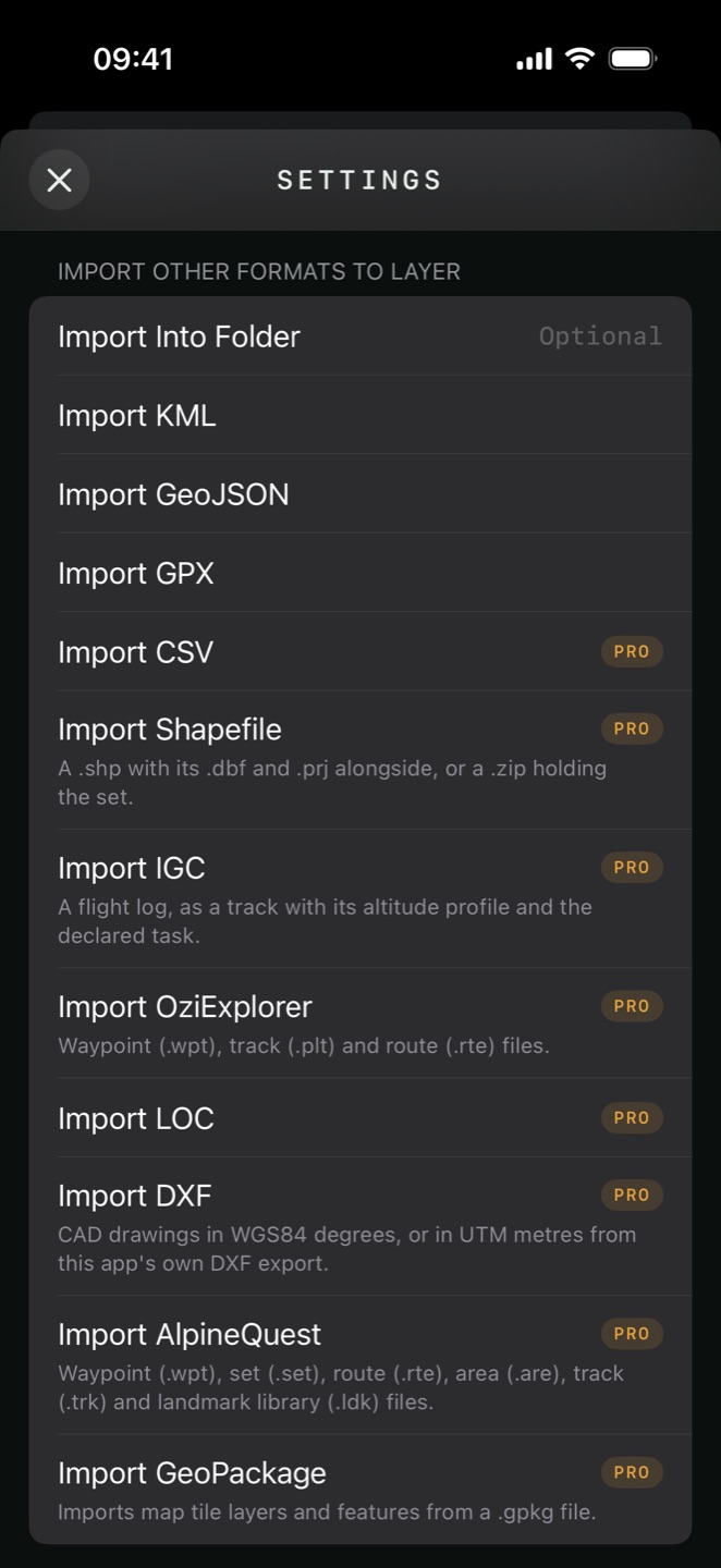
Settings → Import Other Formats To Layer. Everything lands in the active layer unless you name a destination folder first.
| Format | Extensions | Notes | Tier |
|---|---|---|---|
| KML / KMZ | .kml .kmz | Folders, tags, attributes, photos and ground overlays round-trip | FREE |
| GeoJSON | .geojson | Points, lines, polygons and their properties | FREE |
| GPX | .gpx | Waypoints, routes and tracks | FREE |
| CSV / TSV | .csv .tsv | Recognised by its headers | PRO |
| Shapefile | .shp or a zip | Any projected CRS, read from the .prj | PRO |
| IGC | .igc | Flight logs | PRO |
| OziExplorer | .wpt .plt .rte | Waypoints, tracks, routes | PRO |
| LOC | .loc | Geocaching waypoints | PRO |
| DXF | .dxf | CAD drawings | PRO |
| AlpineQuest | .wpt .set .rte .are .trk .ldk | Waypoints, sets, routes, areas, tracks and landmark libraries | PRO |
| GeoPackage | .gpkg | Tiles, features and elevation at once | PRO |
| GeoTIFF / GeoPDF | .tif, GeoPDF | From Map Type — becomes a custom map | PRO |
| AlpineQuest maps | .aqm | From Map Type | PRO |
| MBTiles | .mbtiles | From Map Type, file or URL | PRO |
| TAK data package | .zip | Markers and maps together | PRO |
.tif, GeoPDF, .gpkg, .mbtiles, .aqm), which go
into Custom Maps rather than a layer. See Maps
& Overlays.<GroundOverlay> — a georeferenced image baked
into the file — imports as an image overlay
rather than an item, positioned from its lat/lon box. Remote-hosted overlay images are skipped; the
picture has to be inside the KMZ. PRO<ExtendedData> and a
GeoJSON feature's properties import into each item's
Attributes table, and export back out the
same way.name, latitude, longitude, elevation,
description — the same layout the app exports, so it reads its own output.geopackage import PRO
A GeoPackage can hold three different things, and the app reports what it found before importing anything.
- Open Settings → Import GeoPackage and Choose .gpkg File.
- Read the inspection panel: Tile Layers, Feature Layers and Elevation Layers with their counts and zoom ranges.
- Choose where features go — a new layer per table, or all of them into the current layer.
- Import.
exporting
Settings → Export Layer to Other Formats writes the active layer and hands it to the share sheet. All exports are Pro.
| Format | Carries |
|---|---|
| KML | Items, styling, folders, tags and attributes |
| KMZ | All of that plus photos and voice memos embedded |
| GeoJSON | Geometry, with attributes as feature properties |
| GPX | Waypoints, routes and tracks |
| CSV | Points as a table |
| DXF | CAD geometry in UTM metres, with the zone recorded |
| Shapefile | A zip of up to three datasets — points, lines, polygons |
| GeoPackage | Everything in one WGS84 container |
| JSON / ZIP bundle | The app's own lossless format |
RADIUS_M,
WIDTH_M and HEIGHT_M preserved in the attribute table so nothing is
lost.backup & restore PRO
An exported layer is one layer. A .tgpsbackup is the whole app in one file: every layer with its attachments and custom icons, every recorded track with its activity and laps, your custom map sources, offline region definitions, map presets and settings.
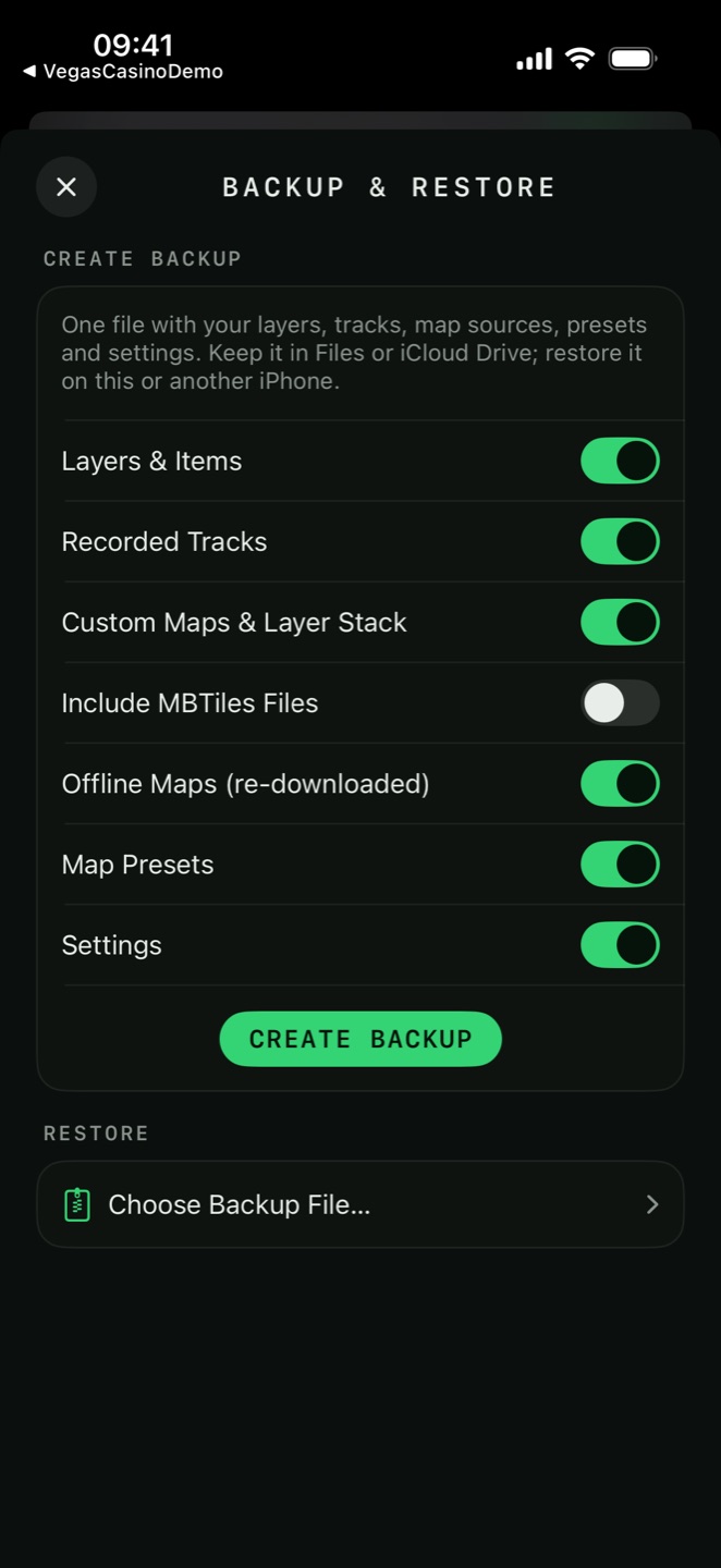
Settings → Data Import & Export → Backup & Restore.
- Under Create Backup, tick what to include.
- Tap Create Backup. The file is written and offered through the share sheet — save it to Files, iCloud Drive or anywhere else.
- On the new device, open the same screen, tap Choose Backup File… and pick it.
- Read the Contents summary — layers, tracks, custom maps, offline maps and presets, with counts.
- Choose Merge or Replace, then Restore.
| Include | Notes |
|---|---|
| Layers & Items | With attachments and custom icons |
| Recorded Tracks | With activities and laps |
| Custom Maps & Layer Stack | Source definitions and the overlay stack |
| Include MBTiles Files | Off by default — these are often hundreds of megabytes |
| Offline Maps (re-downloaded) | The region definitions; tiles re-download afterwards |
| Map Presets | Your saved map setups |
| Settings | Units, formats, grid, tracker and navigation preferences |
.tgpsbackup opened from the Files app goes straight to this
screen — the app owns the file type.choosing a format
| You want to… | Use |
|---|---|
| Move to a new iPhone | Backup & Restore |
| Archive a layer losslessly | Export & Share Layer (JSON / ZIP) |
| Send a route to another GPS app | GPX |
| Send pins with their photos | KMZ |
| Open it in Google Earth | KML or KMZ |
| Open it in QGIS or ArcGIS | Shapefile or GeoPackage |
| Open it in CAD | DXF |
| Put it in a spreadsheet | CSV |
| Work with a team live | iCloud sharing, not a file |