
Field manual · 01/17
Getting Started
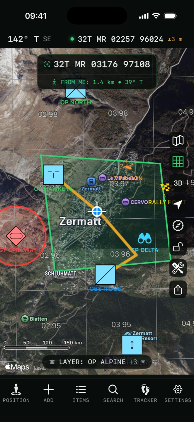
Tactical GPS is a single full-screen map. There are no buried menus: everything hangs off four surfaces — the control column on the right edge, the tab bar at the bottom, the quick-action chips above it, and the tool dock that appears while a terrain tool is running.
the control column
The column of buttons down the right edge of the map, top to bottom. Some appear only when they apply, so the column is shorter than this list until you give it a reason to grow.

Map Type
The map sheet: base maps, the overlay stack, your own imported maps, offline regions and saved presets. See Maps & Overlays.

Grid
Shows or hides the coordinate grid overlay. Hidden on base maps that cannot carry a grid.
3D
Tilts the map into real terrain and buildings. Appears only on Apple Standard, Satellite and Hybrid, the three base maps where tilting shows actual 3D content. Drag with two fingers to change the tilt. Flyover maps are permanently 3D, so they have no button.

Center on me
Centres the map on your position and follows you as you move.

Compass
Locks the map to north and shows a compass. Tap again to release rotation.
Pan / draw
Appears only while you are sketching freehand. Switches the drag gesture between moving the map and drawing on it.

Lock
The padlock freezes the map. Pan, zoom, rotate and tilt all stop until you unlock, and the button turns red. For a map in a pocket, on a vehicle mount, or in gloves.

Tools
The wrench opens the twenty-tool sheet — measurement, terrain analysis, weather, printing and the converters. See Field Tools.

Share layer
Appears once a layer is selected. Offers the layer as a file or starts a live iCloud share.

Recording indicator
Blinks red while a track is recording. Appears only during a session; tap it to open the live session.

TAK
The antenna appears once a TAK server host is configured. Opens the team panel. See Team — TAK Server.
the tab bar

Position
Your location in every format at once, with altitude, speed, heading and weather on reorderable cards. See Coordinates & Position.

Add
Creates an item on the map: Pin, Polyline / Route, Polygon, Circle, Rectangle, Label, Photo, Elevation / Depth, Freehand or Directions.

Items
The list behind the map: search, filter, sort, folders, tags and batch editing. See Items, Folders & Tags.

Search
Jump to a coordinate in any format, a grid reference, a saved pin or an address — and project a new point by bearing and distance.
Tracker
Record, review and export GPS tracks. See Tracker.
Settings
Everything configurable, in twelve sections. See Settings, Shortcuts & Automation.
quick-action chips
A row of chips sits above the tab bar for the things you do constantly. Tap to fire; no sheet, no menu.
map gestures

Move the map
Panning puts a crosshair at the centre, and the app continuously shows the distance and bearing from your position to it. Every terrain tool runs from that crosshair, so positioning the map is aiming the tool.

Tap a pin
Opens its details: navigate to it, get directions, check the weather there, send it over TAK, or edit it.

Tap a shape
Shows its measurements — length, area or radius — with its editing options.
Long press
Drops a pin where you pressed. Change it to Move Crosshair There, or switch it off, in Settings → General → Map Long Press.
where things live
| You want to… | Go to |
|---|---|
| Read your grid reference | Position tab, or the readout at the top of the map |
| Change coordinate format or datum | Settings → Formats & Units |
| Turn the grid on, or restyle it | Grid button on the map; Settings → Grid |
| Switch base map or add an overlay | Map Type button |
| Download maps for offline use | Map Type → Offline Maps |
| Save a pin at a typed coordinate | Items tab → ADD |
| Find a pin you saved | Items tab, or Search → Search Pins |
| Navigate to something | Tap it → Navigate |
| Record where you went | Tracker tab |
| See what is visible from a hilltop | Tools → Viewshed |
| Measure a distance or an area | Tools → Measure Distance / Area |
| Print a paper map sheet | Tools → Print Map |
| Import a GPX someone sent you | Settings → Import Other Formats To Layer |
| Move everything to a new iPhone | Settings → Data Import & Export → Backup & Restore |
| Connect to your team | Settings → Team → TAK Server |
| Go red for night work | Settings → General → Night Vision |
the app tour
The first launch opens a short App Tour — seven screens of the features people look for first. Skip it at any point, and replay it later from Settings → Info → App Tour.
free and pro
The download is free and stays free. Full-precision MGRS, UTM and national grid readouts, the grid overlay, compass navigation, measurement, range rings, Sun & Moon, NATO symbols, night vision and KML/GPX import are all included with no purchase and no trial clock.
The free tier is capped at three pins and one route, a single layer, 5 km of viewshed and five-minute TAK sessions. Pro is a one-time purchase that lifts those limits and unlocks offline maps, routed navigation, the terrain analysis tools, track recording, import and export, and iCloud layer sharing.