
Field manual · 08/17
Tracker
The Tracker records where you have been — for after-action review, for proof of coverage, for a training log, and for finding your way back. It keeps recording with the app closed and the screen off.
starting a session
- Open the Tracker tab and start recording. The red indicator in the map controls blinks while a session is live — tap it any time to jump back to the session.
- Pick the activity. It colours the session, filters the list, feeds the calorie estimate and is written into the GPX as the track type.
- Walk. Use LAP to mark sections and Mark to drop a pin at the current fix without leaving the screen.
- Stop when you are done. The session is saved to the history.
activities and laps
Ten activities, picked from a sheet when you start or changed afterwards in the session view:
| Activity | Activity | Activity |
|---|---|---|
| Hiking | Walking | Running |
| Cycling | Mountain Biking | Skiing |
| Paddling | Driving | Flying |
| Other |

Track folders PRO
A session's row menu has Move to Folder… — pick an existing folder or New Folder…. Filed sessions group under a collapsible amber header with a count, which keeps a season of recordings, or one trip's legs, together in the list.
Laps
The LAP button drops a section mark while recording. The session then shows a lap table with distance, time, pace and ascent for each lap, and the lap points are marked on the elevation profile and on the map. Laps are carried in the CSV export.
how densely it records
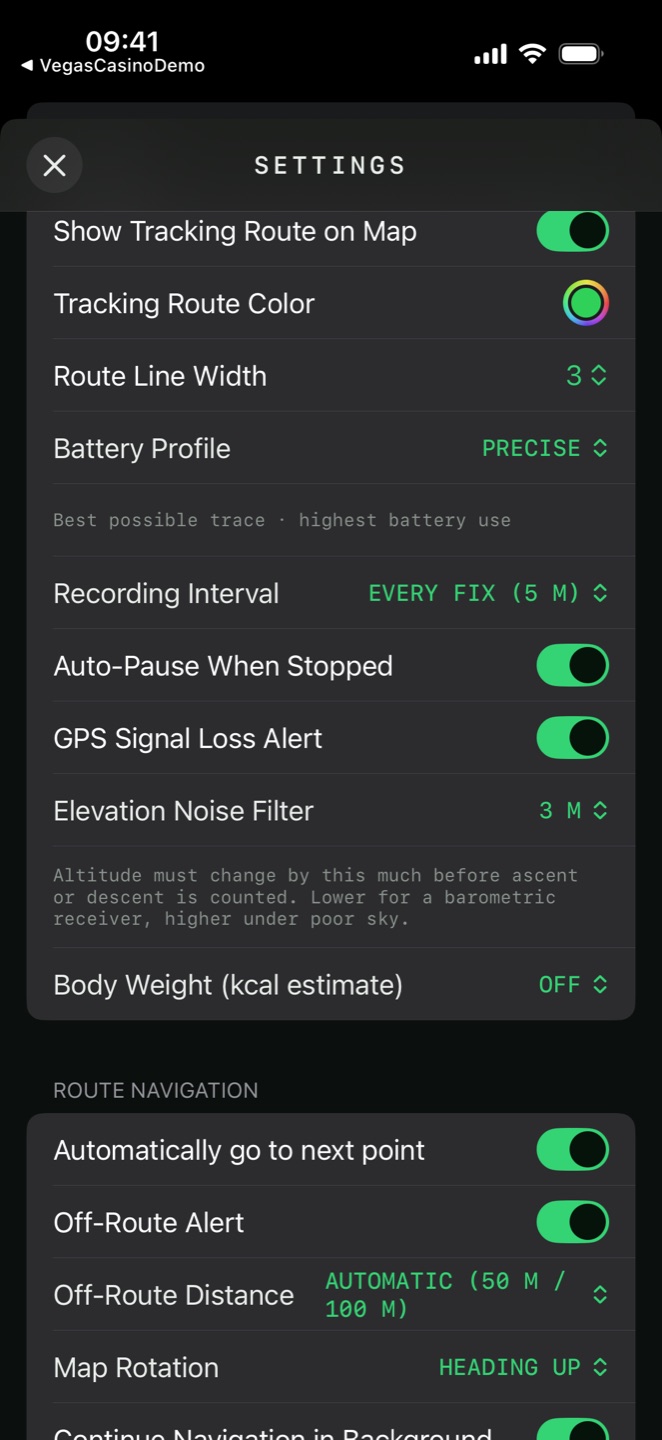
Settings → Tracker → Recording Interval sets how often a point is kept:
- Automatic (by speed)
- Roughly one point every 3–4 seconds at any pace
- By distance
- Every fix (5 m), every 10 m, 25 m or 50 m
- By time
- Every 5, 15, 30 or 60 seconds

Battery profile
Settings → Tracker → Battery Profile trades precision against endurance. It seeds the recording interval, which you can still change afterwards.
| Profile | The app says | Fix accuracy |
|---|---|---|
| Precise | Best possible trace · highest battery use | Best for navigation |
| Balanced | ~10 m fixes · good for hikes of a day or more | Nearest ten metres |
| Power Saving | ~100 m fixes · multi-day trips, coarse trace | Nearest hundred metres |
pauses, warnings and interruptions
The session badge tells you what the recorder is actually doing:
- REC
- Recording normally
- MOVING
- Movement detected
- PAUSED
- You paused it
- AUTO-PAUSED
- Auto-paused — standing still
- GPS LOST
- Signal lost, or a fix rejected as a spike
reviewing a session
A saved session shows the track on a map with the full statistics:
| Group | Readouts |
|---|---|
| Distance & time | Distance, Duration, Moving time |
| Speed | Average speed, Overall average, Max speed, Pace |
| Vertical | Ascent, Descent, Ascent rate, Elevation |
| Effort | Effort Dist, Calories, Laps |

The interactive profile
Elevation and speed profiles with an X-axis toggle between Distance and Time. Drag across the curve and the point under your finger is marked on the map preview — so a hard section on the graph becomes a place on the ground. High and low points and lap marks are drawn on the curve.
Calories
Estimated from the activity's metabolic equivalent, your moving time and your body weight. Weight is off by default — set it in Settings → Tracker → Body Weight (kcal estimate), from 50 to 120 kg, and the estimate appears.
Session actions:
time, latitude, longitude, altitude_m, speed_mps, lap,
with ISO-8601 timestamps.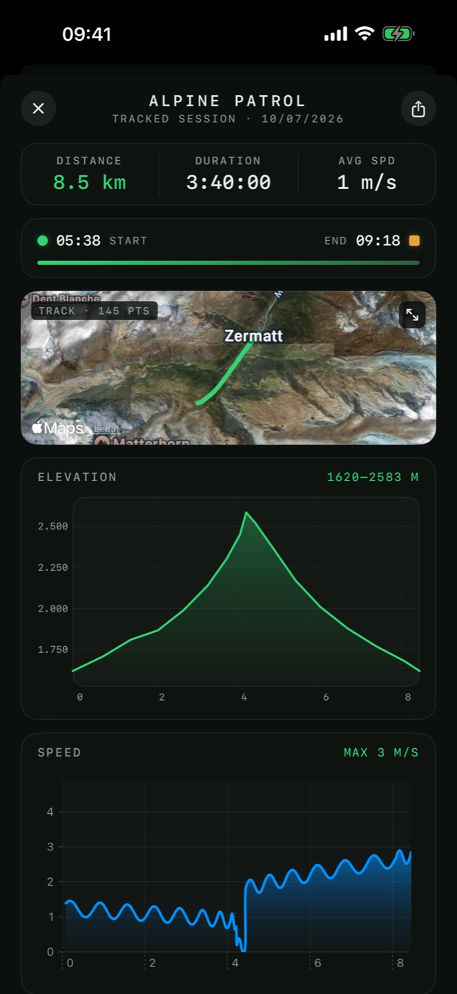
widget, live activity and watch

Home-screen widget
Shows the running session with DIST, MOVING, SPEED and ASCENT, or NOT RECORDING with a Start pill that opens the Tracker.

Live Activity
A Lock Screen card and Dynamic Island presence with the same readouts plus TOTAL, and working Pause, Resume and Stop buttons — so a session is controlled without unlocking the phone.

Apple Watch
Start and stop from the wrist with live distance and elapsed time. See Apple Watch.